NOAA via AP
·
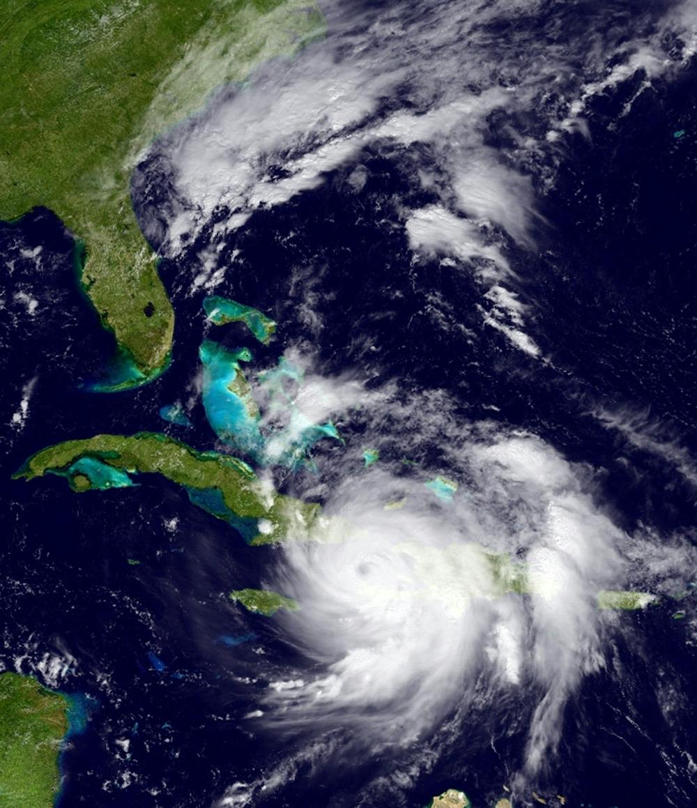
The GOES East satellite image provided by the National Oceanic and Atmospheric Administration (NOAA) and taken Tuesday, Oct. 4, 2016 at 1:12 p.m. EDT, shows Hurricane Matthew over the Caribbean region. Hurricane Matthew roared across the southwestern tip of Haiti with 145 mph winds Tuesday, Oct. 4, 2016, uprooting trees and tearing roofs from homes in a largely rural corner of the impoverished country as the storm headed north toward Cuba and the east coast of Florida.
More

_DSC7430.JPG
By Delia Rose Sauer | July 4Chris Deutsch and her daughter Tamara Deutsch stand at the corner of Depot Park on Friday, July 4, 2025.

_DSC7406.jpg
By Delia Rose Sauer | July 4A protester carries a sign as the crowd chants at Depot Park on Friday, July 4, 2025.

Sydney Sutton
By Johnny Zhang | June 27Gators track and field commit Sydney Sutton poses at the New Balance Nationals Outdoors at Franklin Field in Philadelphia, Pennsylvania June 22