The latest predictions of Hurricane Dorian show that the storm is moving east, away from central Florida and possibly from even making landfall.
The National Hurricane Center announced on Saturday at 5 p.m. that tropical storm warnings were in effect for Indian River County, but interests in Central Florida should continue to monitor the storm. Dorian currently remains a Category 4 Hurricane with sustained winds of 150 mph, just 6 mph shy of a Category 5.
The latest update from NHC shows Dorian moving further away from Gainesville. However, the University of Florida, Santa Fe College and Alachua County Public Schools will remain closed on Tuesday.
Mayor Lauren Poe tweeted about the news, saying “This is welcome news for our area, but it’s way too early to let our guard down.”
UF’s emergency updates website announced Saturday afternoon that Gainesville should prepare for 3-4 inches of rainfall, a 46% chance of tropical storm force winds and a 3% chance of hurricane force winds, based on current storm forecasts.
The National Hurricane Center will be announcing an intermediate update on Hurricane Dorian at 8:00 p.m. AST.
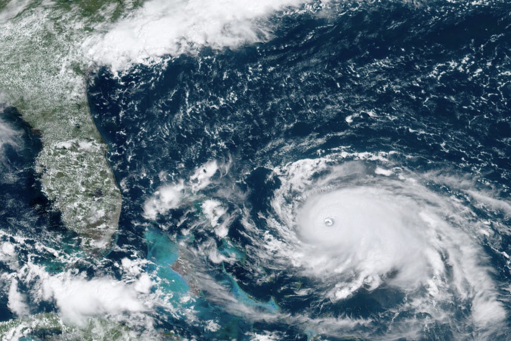
This GOES-16 satellite image taken Saturday, Aug. 31, 2019, at 16:00 UTC and provided by National Oceanic and Atmospheric Administration (NOAA), shows Hurricane Dorian, right, churning over the Atlantic Ocean. Hurricane Dorian bore down on the Bahamas as a fierce Category 4 storm Saturday, with new projections showing it curving upward enough to potentially spare Florida a direct hit but still threatening parts of the Southeast U.S. with powerful winds and rising ocean water that causes what can be deadly flooding.(NOAA via AP)